Kiribati: Capital, Flag and Fun Facts
The capital of Kiribati is Tarawa. Many references give South Tarawa; most government ministries are at Bairiki and parliament is at Ambo, both on South Tarawa.
About Kiribati
Kiribati is a country of 33 coral atolls and islands spread across a huge area of the central Pacific Ocean, along the equator. Most of its land is low and flat, with coconut palms, white beaches and blue lagoons. Its islands form three groups: the Gilbert, Phoenix and Line Islands.
About Tarawa
Tarawa is an atoll in the Gilbert Islands, a chain of low coral islets around a lagoon. Most people live in South Tarawa, where the islets are joined by causeways.
Fun facts about Kiribati
- Kiribati straddles both the equator and the 180th meridian, so its islands lie in all four hemispheres.
- In 1995 Kiribati moved the International Date Line so that all of its islands share the same date.
- Kiritimati, also called Christmas Island, is one of the first inhabited places on Earth to welcome each New Year.
- The Phoenix Islands Protected Area became a UNESCO World Heritage Site in 2010 and covers a vast area of ocean.
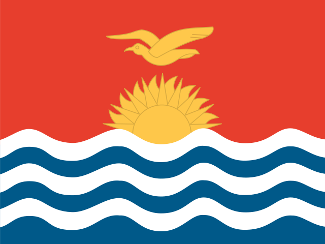
- Kiribati's flag shows a golden frigatebird flying over a rising sun with 17 rays and ocean waves.
- In the Gilbertese language 'ti' sounds like 's', so Kiribati is said 'KEER-ee-bass'.
Find Kiribati on the mapPlay the Oceania capitals quiz
Sources
- www.britannica.com/facts/Kiribati
- en.wikipedia.org/wiki/Kiribati
- en.wikipedia.org/wiki/Geography_of_Kiribati
- en.wikipedia.org/wiki/Kiritimati
- en.wikipedia.org/wiki/Flag_of_Kiribati
- whc.unesco.org/en/list/1325/
- raw.githubusercontent.com/factbook/factbook.json/master/australia-oceania/kr.jso
- en.wikipedia.org/wiki/South_Tarawa